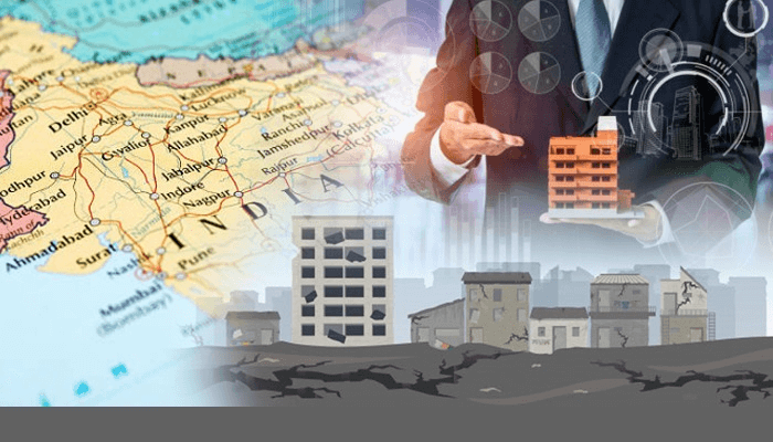
IIITH collaborates with National Disaster Management Authority (NDMA) to develop an Earthquake Disaster Risk Index (EDRI) for cities.
Index based on pilot study of 50 selected Indian cities located in seismically active regions
Risk has been categorized as Low, Medium and High
The hope is that the report will help the appropriate decision makers and town planners in prioritizing disaster preparedness in vulnerable cities
There’s a well-known saying: Earthquakes don’t kill, Buildings do! A large part of the losses incurred during earthquakes is directly because of the type of housing prevalent. This is especially true in the case of India. Look at the 2001 Bhuj (Gujarat) earthquake which recorded 7.7 on the Richter scale. It caused about 13,000 deaths, whereas a relatively smaller sized (M6.4) Latur (Maharashtra) earthquake in 1993 caused about 8,000 deaths and wiped out 52 villages. This colossal loss of life is attributed directly to the collapse of houses.
Disaster Management Act, 2005
It was in the aftermath of the Latur earthquake that the Government of India (GOI), recognised the importance of Disaster Management as a national priority. It first set up a High-Powered Committee (HPC) in August 1999. Efforts in this direction were intensified after the Bhuj earthquake (in 2001) with a National Committee being set up for making recommendations on the preparation of Disaster Management plans and suggesting effective mitigation mechanisms. Finally in 2005, with the enactment of the Disaster Management Act, the National Disaster Management Authority (NDMA) was created. Under the Disaster Management Act, the focus of managing disasters is not just on evacuation, rehabilitation and rescue efforts but also on prevention of danger or threat, reduction of risk, capacity building and preparedness to deal with any disaster. In fact NDMA highlighted the need for a holistic and integrated risk reduction strategy.
Risk Assessment
Since 2006, IIITH researchers at the Earthquake Engineering Research Centre (EERC) have been working on assessing the risk of earthquakes on buildings. “About 56% of Indian land is prone to moderate to severe earthquakes. And unfortunately about 82% of our population is living on this land. So technically speaking, 4 out of 5 people are under earthquake threat,” says Prof. Pradeep Ramancharla, EERC. One of the aims of the group was to increase general awareness among the public about earthquake safety, and to make homes earthquake resilient. While one way deals with educating architects and engineers in putting in place an adequate framework for new buildings, another manner is to determine the risk of existing buildings and to suggest techniques for reinforcing the same.
Over a course of 13 years that spanned 3 projects across various states and cities, the IIITH team painstakingly created a risk assessment index. It comprises of three components namely, earthquake hazard, exposure and vulnerability of a city. “Earthquake hazard refers to the amount of ground shaking that an area will experience; exposure refers to the number of buildings present in that area, and vulnerability refers to the strength of the building to withstand an earthquake,” explains Prof. Ramancharla. The researchers’ efforts lay in reducing vulnerability. “Hazard is governed by nature, town planning and the local government bodies influence exposure. So our focus was on vulnerability which is in the hands of architects and engineers,” says Prof. Ramancharla. Using a combination of physical surveys on ground and risk assessment, the team also recorded vibration data on selected buildings. This was then fed into computer modelled buildings to simulate the effects of earthquakes of varying intensities. In this way, physical damage to buildings during earthquakes could be quantified. The risk which is initially estimated of individual building typology in a city, is eventually projected onto the city using the census data of total number of buildings in that city of that typology.

Teaming Up With NMDA
A pilot study was commissioned by the NDMA where the cities were selected based on the population density, housing threat factor and the cities identified by the Government to develop as Smart Cities. The major area of focus was the seismically active regions in India, i.e., seismic zones IV and V. Considering these factors, a total of 50 cities were selected. Of these, 15 cities were selected from seismic zone V, 28 cities from seismic zone IV, and the remaining 7 were metro cities. Risk was estimated for these selected cities in the form of low, medium and high risk.
The study revealed that as cities were selected from the higher seismic zones, no city has low hazard level. Cities with hilly terrain have low exposure, whereas cities with flat terrain and high populations have high exposure. The vulnerability of each city depends only on the construction typology adopted. Hence of the 50 cities, the vulnerability of built environment is low in only 5 cities, medium in 36 cities and high for 9 cities. The final result of the Earthquake Disaster Risk Index (EDRI) shows that, of the 50 cities, only 7 cities have low level risk, whereas 30 cities have medium level risk and 13 cities have high level risk.
The Way Forward
While admitting that the EDRI is based on the results of a pilot study involving selected cities, Prof. Ramancharla suggests a detailed structural evaluation of vulnerable buildings so that suitable riders can be put in place on developmental activities along with retrofitting measures adopted by the policy makers. “The EDRI will be helpful in increasing significant awareness among the people residing in highly seismic vulnerable areas,” says Prof. Ramancharla. The idea is to achieve this by not only conducting awareness programmes and establishment of demonstration retrofitting units, but also engaging with locals so that they can identify vulnerable hazardous buildings and can plan for quick repair and restoration.
Complete EDRI report at https://ndma.gov.in/images/guidelines/EDRI_Report_final.pdf

Sarita Chebbi is a compulsive early riser. Devourer of all news. Kettlebell enthusiast. Nit-picker of the written word especially when it’s not her own.


Next post