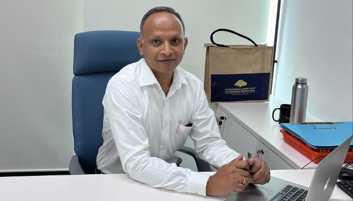
Meet Prof. Kiran Chand from the Lab of Spatial Informatics. Faculty and researcher by day, woodworker and baker by night. In a free wheeling conversation, he talks about the importance of spatial perspectives and why they matter to everyone.
Prof. Kiran Chand likes to look at the larger picture. And if that picture is an aerial-view, then even better. “Have you seen a hedge maze?,” he asks. “It’s difficult to navigate when you are in it with each turn being uncertain. But if you get an aerial view of the same maze, you can see how the paths connect, where they lead and how the pieces fit together – the things that you don’t understand at a localized level, you can connect with spatially.” It’s this idea of looking for answers spatially – stepping back to see connections that may be invisible up-close – that runs across his career.
An Associate Professor with the Lab of Spatial Informatics, IIIT-H, Prof. Kiran Chand’s courses on remote sensing cover the entire gamut – from how satellite sensors are built, the way they function, to the physical principles they operate on, the purpose they serve, and how the data they capture is obtained, downloaded, corrected, and ultimately analyzed. “It’s like taking pictures of yourself at regular intervals and then analyzing them to see how you’ve changed over the months or years,” he says, simplifying the idea. What excites the professor is the journey of information, from pixels captured by satellite sensors to insights that can eventually be used by a wide range of people. “From policymakers, researchers and scientists to laypersons – even an auto driver using Google Maps to navigate – you can see how satellite data touches different lives,” he explains.
He also teaches Earth System Science and Modelling, a field that looks at how different parts of the Earth like air, water, land, plants and people are connected. By bringing together spatial data and scientific models, it helps us understand how human activity and climate change are altering the world around us.
How The Spatial Context Came To Matter
Prof. Kiran Chand’s career path didn’t unfold by design; it was shaped by circumstance and opportunity. Born in Chirala, Andhra Pradesh, he initially aspired to be a doctor. But when he couldn’t secure a free medical seat, he shifted focus and pursued an undergraduate degree in Botany Honours. His decision to enrol for a Master’s degree in Environmental Sciences soon after, he explains, was shaped by a series of global developments that were changing how the environment was understood. The discovery of the ozone hole in the mid-1980s, followed by various international protocols and conventions, brought environmental concerns firmly onto the global agenda through the 90s. By the mid-1990s, he says, there was a paradigm shift in how the relationship between the environment and economic development was understood.
“The prevailing idea until then was that there was the environment on one end and, on the other, economic development. But it was becoming increasingly clear that the two could not be mutually exclusive, The Millennium Development Goals followed in 2000 and so did the current earth observation systems. Space science, in my perception, is the only single-window opportunity to observe the Earth as one unit and to address these issues at global scale,” says Prof. Kiran Chand.
Aiming High With ISRO
Prof. Kiran Chand joined ISRO as a Research Scientist and began to pursue a PhD under the Geosphere Biosphere Programme. His research focused on pollution from open biomass burning. “This includes forest fires, smoke emitted by chulhas typically used in North India, stubble burning of crops and so on. We had to quantify the numbers,” he explains. His primary focus was on jhum cultivation or ‘shifting cultivation’, referring to the slash and burn type of agriculture that is followed in the North East.
Reporting precise numbers is important because the pollutants contribute to global warming by trapping heat. But measuring the scale of these emissions across a country as vast and varied as India cannot be done simply by visiting every field or forest. This is where a combination of ground instruments and satellite imagery comes in handy. While ground instruments provide detailed measurements at specific locations, satellites then provide the spatial scale needed to extrapolate those measurements across much larger areas. Satellite data plays an even larger role when the quantification needs to be scaled up at the regional or national level.
The Golden Minutes
It was one of the outcomes of this pollution-monitoring project that eventually led to fire monitoring being included among the six disasters monitored under ISRO’s Decision Support Centre. Prof. Kiran Chand states that until then, disaster-related activities were prioritized to floods, droughts, earthquakes and landslides. “Our work on gathering pollution-related data especially on fires led to forest fires coming under its purview.” It also led to the professor transitioning into an Operations role. From around 2008, he was involved in managing a national-level, near-real-time forest fire monitoring service.
“The clock really matters here. Satellite data has to be received, processed and transmitted to the line departments to act upon. The entire chain – from data arriving from space to trickling down to the relevant users on the ground has to be done within a turn-around-time of 30 minutes,” he says.
Forest Adventure
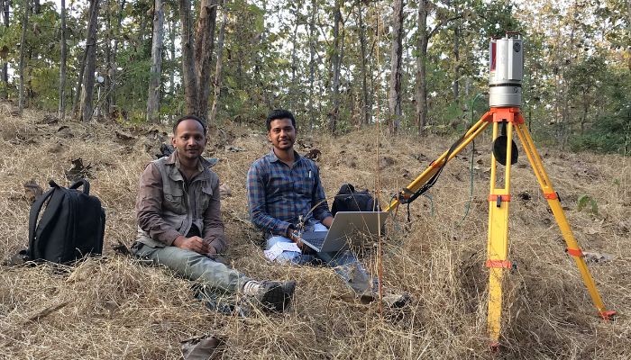
In addition to the monitoring of fires, Prof. Kiran Chand has also been involved with India’s National Carbon Project which tries to quantify how carbon moves into and out of the Earth’s systems. “Forests and vegetation act as carbon sinks, absorbing carbon dioxide through photosynthesis, while deforestation, fires and other human activities add to emissions,” explains Prof. Kiran Chand.
To measure and quantify these exchanges, ISRO has a network of state-of-the-art carbon-flux towers across Indian forests. Some of these towers rise roughly 50 metres above the forest floor and measure carbon dioxide fluxes multiple times every second. The work required monthly visits, data collection and analysis, followed by the use of satellite observations to scale the findings. For Prof. Kiran Chand who was responsible for three of these sites, including forests in Madhya Pradesh and the Kanha Tiger Reserve, as well as the challenging Sundarbans region, getting to these sites itself was something of an adventure.
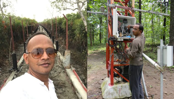
“In Sundarbans, our team had to navigate a specially constructed walkway through an area where man-eating tigers were known to roam. We used to spot pugmarks regularly on the sides,” he chuckles.
Over the course of his career at ISRO, Prof. Kiran Chand’s work increasingly moved beyond scientific measurement into national-level climate and environmental policy. He has represented ISRO in India’s NATCOM (National Communication) cell which prepares reports on emissions and removals from land use, land-use change and forestry for the United Nations Framework Convention on Climate Change. It involved working alongside institutions such as the Forest Survey of India and the Indian Institute of Science.
Changing Gears: From Policy To Academia
From collecting, measuring and interpreting scientific data to feeding this information into national climate commitments, Prof. Kiran Chand has seen it all. But after nearly two decades as a scientist, there were the beginnings of a disquiet and a yearning for freedom to dabble in anything that caught his interest. “I have been interested in academia from the very start and academic freedom was my primary motivation, plus the idea of disseminating my knowledge to good students appealed to me,” he explains when quizzed about his second innings as a professor.
“Unlike in the US, where universities play a significant role in contributing to NASA’s science programmes, space science in India has historically been largely led by ISRO. With the recent changes in policy, this landscape is beginning to evolve, and we are now seeing IITs and other academic institutions increasingly participate in space science. I have a vision of setting up a lab for fire intelligence under Geospatial Intelligence,” he says.
Work At IIIT-H
The Lab for Spatial Informatics at IIIT-H has launched a relatively new dual-degree programme that combines a BTech in Computer Science with an MS by Research in Geospatial Technology. Prof. Kiran Chand’s students are working on a range of applications, from urban planning to climate and environmental research.
One project focuses on urban heat islands, using a digital twin of Hyderabad to generate visual heat maps and understand the extent of heat accumulation across the city. Other research looks at how changing climatic conditions are contributing to more intense fires, how the seasonality of fires is changing, and how such scenarios may evolve in the future using machine-learning methods.
“One of my students is also working on national carbon accounting because I know where the gaps exist, thanks to my prior work with NATCOM. Currently, CO2 equivalents are known only for individual sectors, such as agriculture and power. But these sectors are interconnected, and it is important to understand the linkages between them,” he remarks.
A Jolly Maker
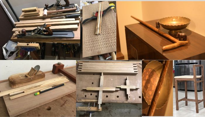
“I like working with hands – building and making things from scratch,” confesses Prof. Kiran Chand when asked about his hobbies. But far from a mere ‘hobby’, his woodworking craftsmanship can put amateurs to shame. He reveals pictures of polished, gleaming tables, artistic and elegant ladles – all fashioned out of solid wood. “It’s self-taught,” he says quickly before one can ask, adding that his living room furniture at home has all been fashioned with his own hands.
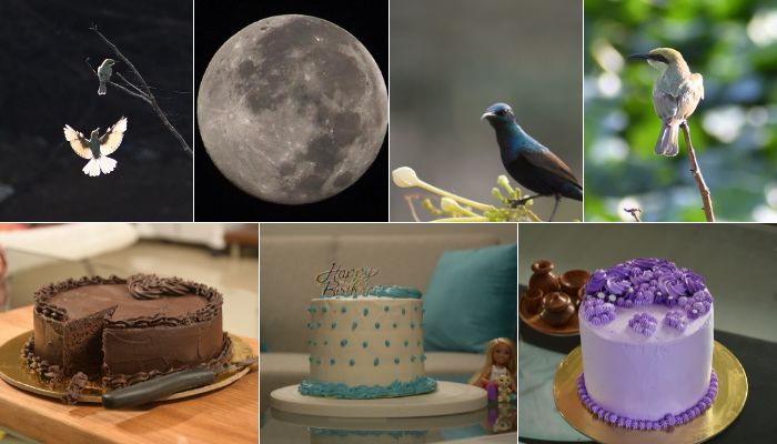
Baking elaborate layered cakes and decorating them with icing for his wife and two daughters is another favourite pastime. “It’s a lot of sugar though and I hardly bake cakes anymore. I’ve moved onto sourdough breads. Even though the entire process is rather time-consuming, there’s something therapeutic about working the dough with your hands,” he reflects. He also works with pottery and is into photography when time permits – something that seems to be getting scarcer for him, especially after the move to academia.
At home, the intellectual banter continues for it is an interesting family of scientists and innovators. The professor’s wife holds a PhD in Biochemistry and is building a startup in CCMB. “Her startup was selected among the top 5 biotech startups at BioAsia 2025,” he says with pride. Their daughters are pursuing their own paths with one still in school and the other having just embarked on an engineering education. Meanwhile, Prof. Kiran Chand continues to connect the dots from scientific insight to real-world impact. That explains why despite spending decades looking at earth from the sky, he has his feet – and hands – firmly on the ground.
Sarita Chebbi is a compulsive early riser. Devourer of all news. Kettlebell enthusiast. Nit-picker of the written word especially when it’s not her own.
Next post