

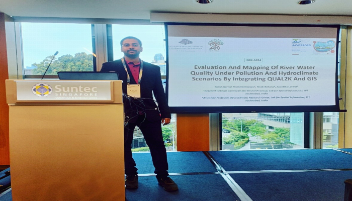
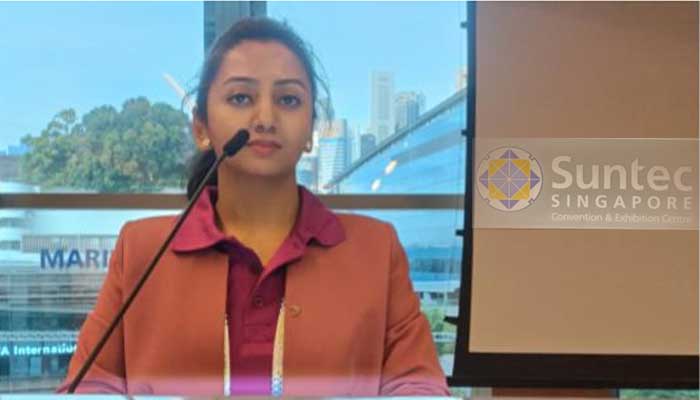
Mummidivarapu Satish Kumar and Avantika Latwal, Ph.D students, supervised by Dr. Shaik Rehana presented the following papers at an International Conference of the Asia Oceania Geosciences Society (AOGS) 2023 held at Sentech conventions, Singapore from 30 July to 4 August.
- Evaluation and Mapping of River Water Quality Under Pollution and Hydroclimate Scenarios by Integrating QUAL2K and GIS – Mummidivarapu Satish Kumar, Dr. Rehana Shaik, Avantika Latwal.
Research work explained by the authors: River water quality management has become more challenging due to excessive pollutant discharge from the industries, and climate change has exacerbated pollution risks under hydroclimatic variability. In this paper, we aimed to evaluate and map the river water quality under different climatic and pollution scenarios by integrating the river water quality simulation tool-QUAL2K, Water Quality Index (WQI) and Geographical Information System (GIS). This research was applied on the Bhadra river stretch, which is one of the most polluted rivers stretches in India. The water quality model QUAL2K was calibrated (for 91 months) and validated (for 41 months) for simulation of water temperature, pH, Dissolved Oxygen (DO), Biological Oxygen Demand (BOD), nitrates, ammonia, and alkalinity. The WQI was estimated with weighted arithmetic-WQI method by using the QUAL2K simulated river water quality indicators. The water quality maps are developed using equal interval mode with graduated visualization techniques in Quantum-GIS software. The WQI values ranges from 106 to 146 for observed conditions and the results revealed that the study stretch falls in class E/ unsuitable for drinking water quality. The WQI grade changed from class E to class C and class B for the 40% and 50% pollution reduction scenarios. The developed water quality map will help to identify the pollution hotspots to control pollution and the water quality charts under climatic and pollution scenarios are helpful to the policy makers and pollution control agencies.
- Integration Approach of Remote Sensing Techniques with Hydrological Model and Field-Based Observations for Water Quality Monitoring – Avantika Latwal, Mummidivarapu Satish Kumar, Rehana Shaik, K S Rajan.
Research work explained by the authors: Inland waterbodies are under tremendous stress due to increasing nutrient contamination under pronounced land use changes in the contributing watersheds globally. Quantification of contamination of inland waterbodies is limited due to the expensive field-based studies and computationally and data-intensive modelling frameworks. Satellite-based data facilitates in studying the spatial spread of contaminations globally, providing integration and validation with field and modelled estimates. Remote sensing data, when coupled with modelled and field-based observations, it provides a more comprehensive ability to assess and monitor the quality and quantity of water resources. The present study aims to develop a holistic approach to detect and quantify the contamination of inland waterbodies by integrating satellite-based remote sensing data and field observations with water quantity-quality modelling. Therefore, the present study aims to detect contamination using remote sensing techniques and relate to the hydrological modeled observation between the period 2016-2018 in the Bhadra Reservoir. The present study selected parameter was chlorophyll-a (Chl-a) content which was used as a proxy of nutrient contamination derived from Sentinel 2 satellite data. The nutrient load was simulated using a process-based hydrological model, SWAT (Soil and Water Assessment Tool), and field-based nitrates were correlated with satellite-based Chl-a content. The research findings of the present study showed that Chl-a content spread was moderate during the post-monsoon month, and the spread was very low during the winter and monsoon months. The statistical analysis reveals a good correlation between Chl-a (satellite-data based estimation) and nitrate (hydrological model-based estimation). The current study demonstrates the significance of using a hydrological model in conjunction with satellite-based data to monitor and evaluate inland water bodies in a qualitative manner.
Satish and Avantika as student volunteers, contributed to the seamless organization and execution of the sessions. Their responsibilities included a three-day rotational duty as a Session Assistant, ensuring the sessions adhered to the schedule and proceeded without disruptions.
Conference page: https://www.asiaoceania.org/aogs2023/public.asp?page=home.asp
August 2023